


Today we can easily find any place on the map and get directions anywhere using Google Maps and Yandex Maps.
But for literally 20-30 years this was impossible. People had to build routes using paper maps and atlases, which were not only inconvenient, but also often had many inaccuracies.
For example, if you now need to go to a store in an unfamiliar place, you simply enter its name into the application, and in just seconds it will build a route and overlay it in the real world using augmented reality. A few inventions ago, such technologies were unimaginable.
Digital cards are firmly entrenched in our lives, but few people know how they work and what technologies lie behind them. So now we’ll deal with this.
Google Maps and Yandex Maps were different from each other at the start
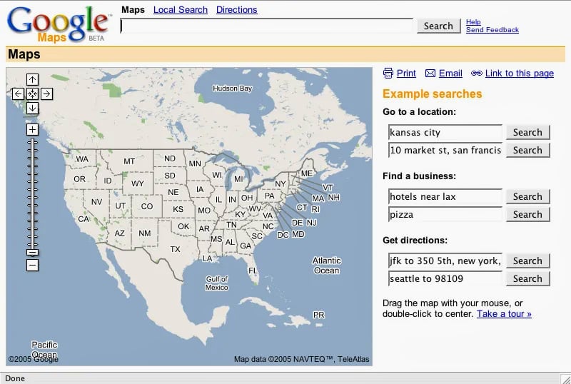
Beta version of Google Maps.
Today we are faced with the fact that Google Maps and Yandex Maps are not very different from each other. Both there and there you can search for places, plot routes, and monitor traffic jams. But in the mid-2000s there were much more differences.
Google didn’t develop Maps from scratch, but bought several startups and rolled them into one product.
In September 2004, Google acquired ZipDash, an early traffic analytics company.
In October 2004, Google bought the startup Where 2 Technologies, which developed the Expedition program for viewing digital maps on a PC.
That same month, Google bought satellite navigation company Keyhole. After the purchase, Google gained access to all satellite images of the Earth.
Google Maps launched on February 8, 2005. These were the first maps on the Internet to use AJAX. For this reason, when users moved the map and changed the scale, the page did not reload.
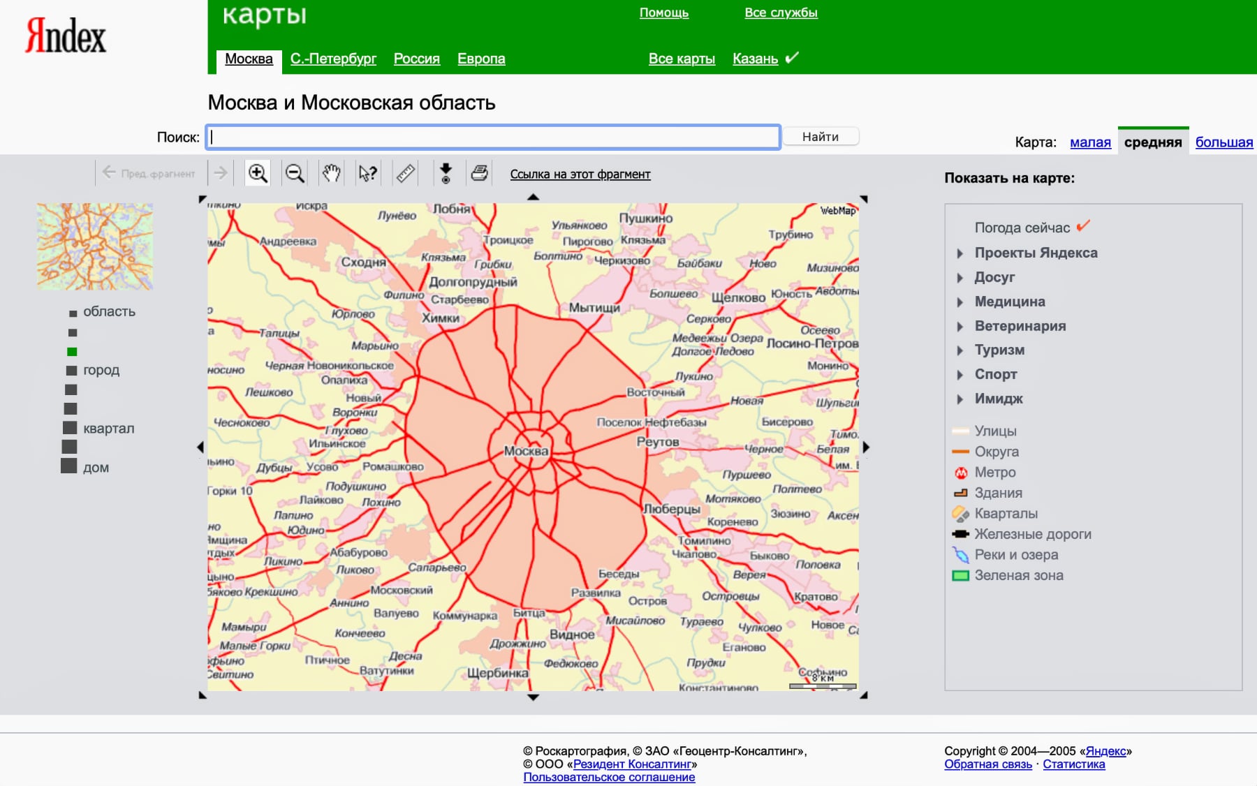
The first version of Yandex Maps.
Google Maps and Yandex Maps were not the first mapping services on the Internet.. By the time they launched, there were already Yahoo! Maps and MapQuest.
But both of these services were slow and were based on old technologies.
In 2003 it was World Wide Wait. It was prehistoric times. You clicked on the map, made a cup of coffee, and then came back.
Noel Gordon, co-founder of Where 2 Technologies and Google Maps
Yandex Maps appeared in 2004, a few months before the release of Google Maps. At this time, users could only view addresses and build routes.
To create memory maps and coordinates
Google and Yandex use similar approaches to creating maps, but there are still some differences between them.
The map is based on satellite images. The company regularly receives fresh satellite images from different regions.
Detailed city maps require high-quality, high-quality products that depict small buildings, roads, sidewalks, and markings. For suburban areas, overview images with large objects are sufficient.
The data is collected on a map using geographic coordinates. This process is called photogrammetry.
In addition, the company relies on other data sources. For example, address databases that store the coordinates of houses and their numbers.
Since Google Maps is used all over the world, unlike Yandex, they have much more data sources. According to Google, When creating a map, it uses information that is compiled from 1000 different sources..
These include the US Geological Survey, the National Institute of Statistics and Geography in Mexico, as well as local municipalities and even real estate developers. In addition, Google and Yandex buy data from other mapping companies.
For example, in Japan Google rents maps from Zenrin, in China – from AutoNavi. Yandex rents cards from ITC ScanEx and Geocenter-Consulting in Russia.
Sometimes it is difficult to make out the outlines of buildings in satellite photographs. Previously, this was a serious problem because all the outlines of the houses had to be drawn by hand. With the advent of machine learning, this process has been automated, and now in Google Maps, building outlines are drawn automatically.
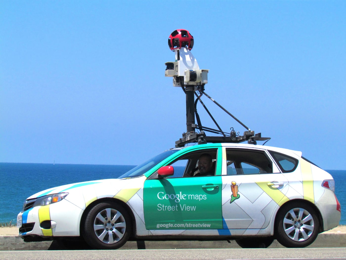
City panoramas are very convincing information. In the case of Yandex, this is Yandex Panoramas, and in Google – Street View.
The Street View service was launched in 2007. Over 12 years, the company captured 170 billion images in 87 countries.
Street View cameras can be found on cars, bicycles and even snowmobiles. Sometimes a person is used instead.
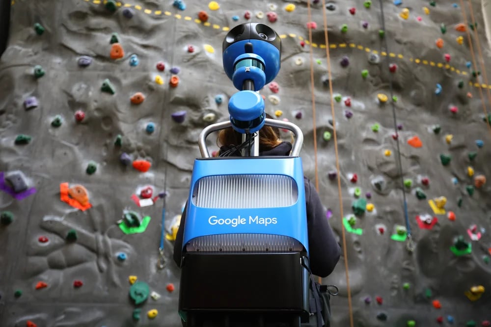
A 360-degree camera is used to view the streets. Sometimes it is connected to lidar to measure the distance to objects. The cameras also have GPS so that the pictures receive accurate coordinates.
With the help of panoramic mappers, you can record various changes: the appearance of new buildings, road signs, traffic lights and companies.
After the map is drawn, organizations and other small objects are included on it. Also at the final stage, Google and Yandex include various useful information: transportation schedules, fuel and parking costs.
Google and Yandex rely on volunteers to edit maps
Interface of the people’s Yandex Map.
It is impossible to make a map once and for all. Cities are constantly evolving, so all changes must constantly appear on the maps.
In this case, there is no point in redrawing the map. This is a waste of time, and besides, when the card is ready, the next day it will no longer be relevant.
Google and Yandex were unable to fully automate the editing processTherefore, all the smallest changes are carried out manually by company employees or volunteers with the help of constructor cards and feedback.
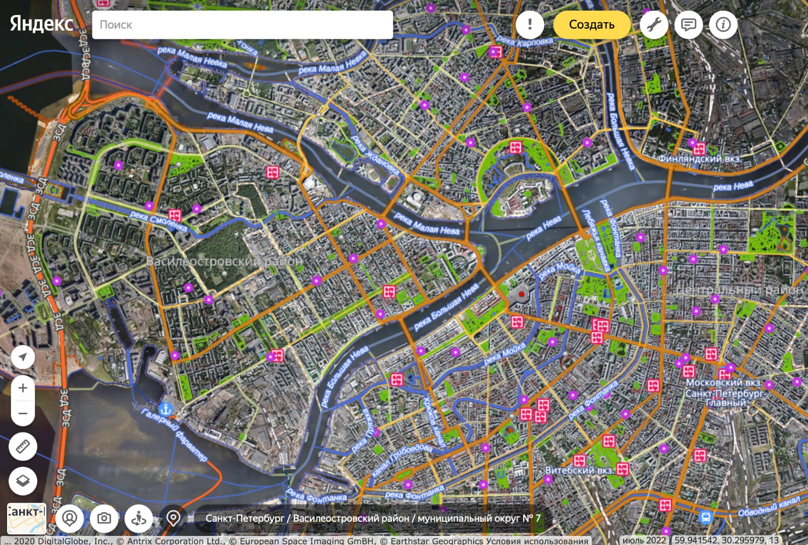
In the Yandex People’s Map, anyone can draw a new road or building, install a camera or a speed limit. This assistance is especially indispensable in hard-to-reach places and small towns.
How Google and Yandex build routes
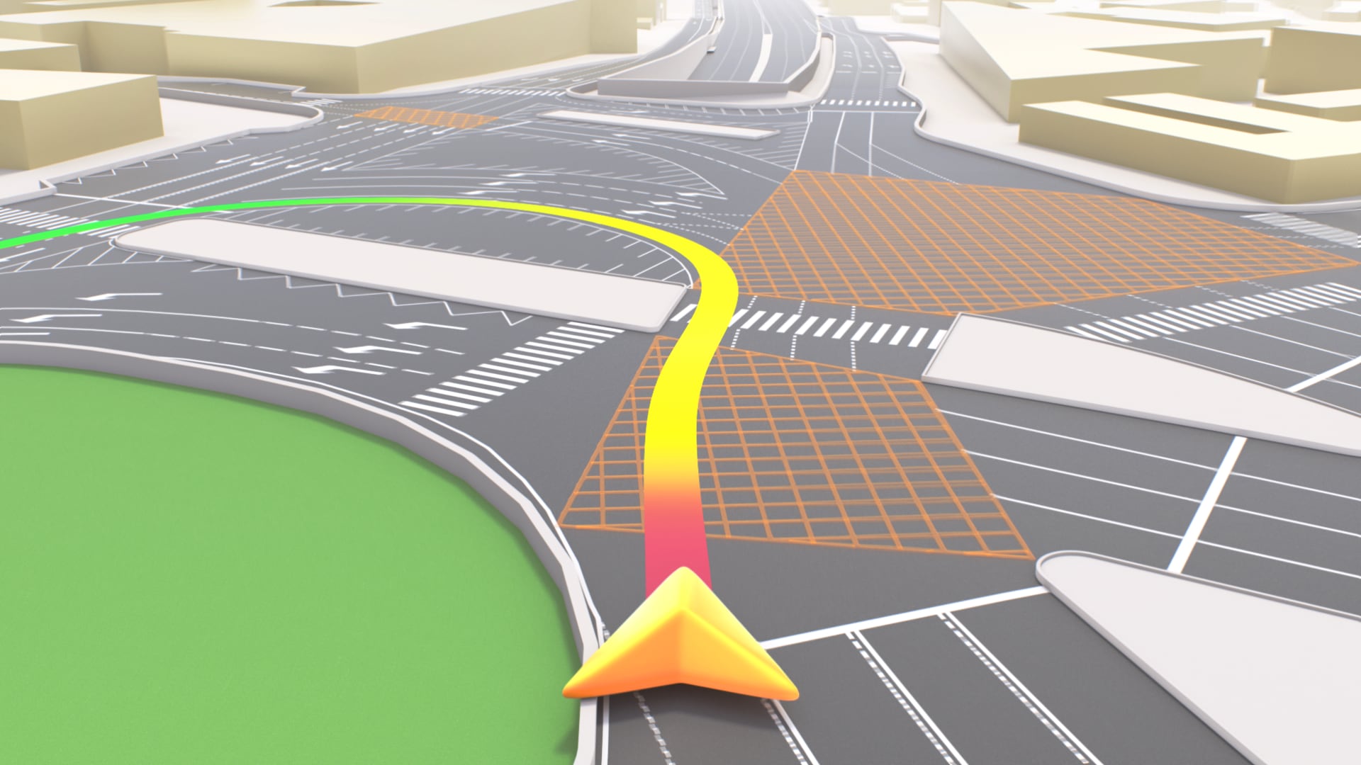
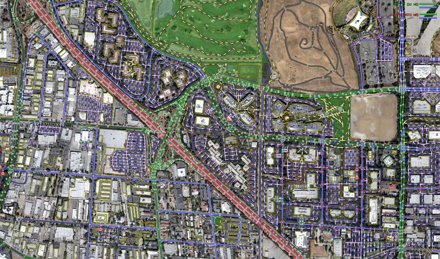
One of the main functions of modern maps is to build routes. In the case of Yandex Maps, a road graph is used for this – a grid of roads.
It consists of fragments that are connected to each other. For example, the road graph of Saratov contains 7592 fragments.
Each graph stores GPS coordinates, information about the direction of travel and the average speed at which the car usually travels in that area.
The graphs are always changing, for example when roads are closed, new signs or restrictions are installed to prevent the movement of cars.
In addition, Yandex anonymously collects information about the movement of cars along the laid routes and records all cases when the movement does not correspond to the included road network.
All routes are calculated using Dijkstra’s algorithm (a method of finding the shortest path in a graph from one vertex to the virus). Yandex calculates the fastest travel option based on the length of each segment of the schedule and the speed of movement on the section. In addition, there are traffic jams along the route, as well as road closures. Therefore, sometimes maps provide location of points along a long route, which takes less time.
Traffic information through various applications
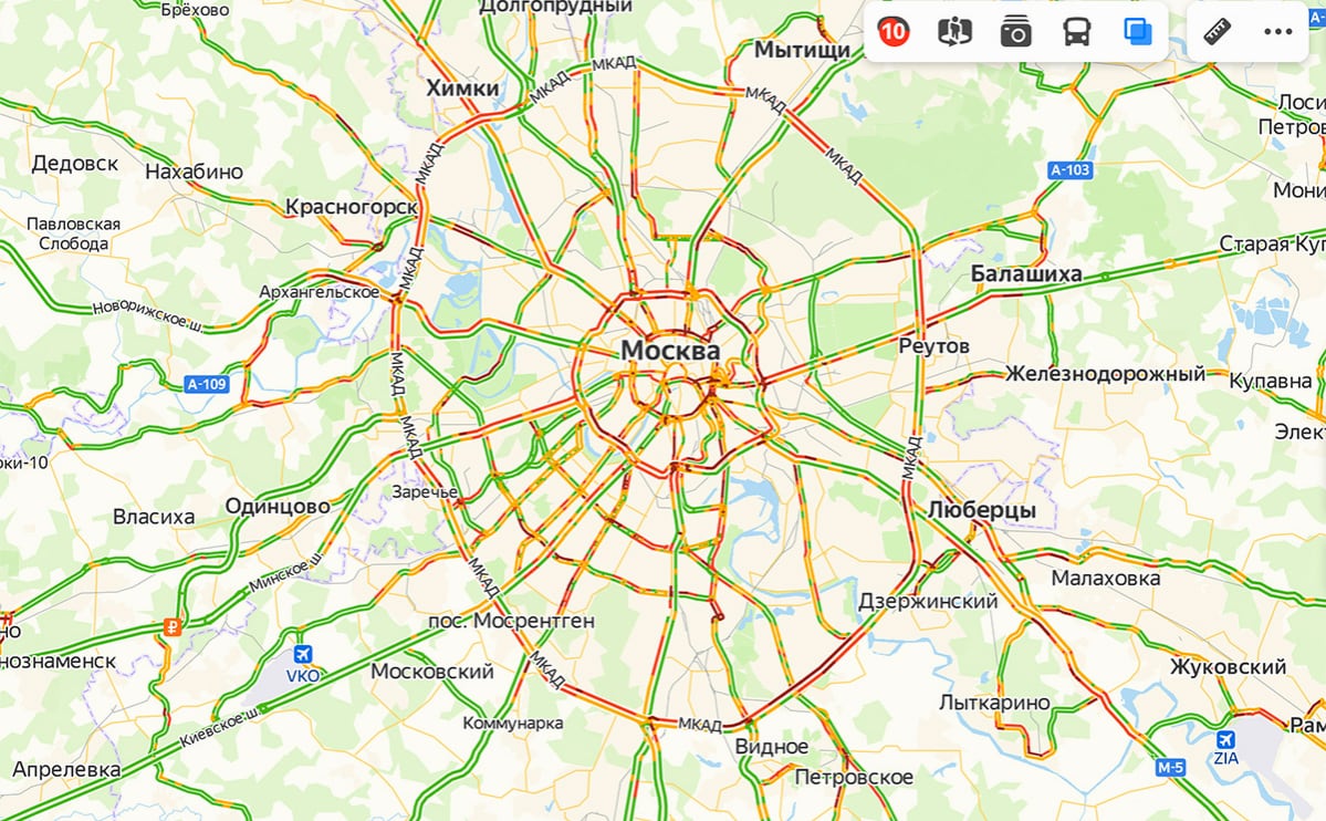
Google Maps and Yandex Maps display information about traffic jams based on data received from users.
In the case of Google Maps, information is provided when users use the application. ethical The data allows us to determine how many cars are on the roads and at what speed they are moving..
In addition, Google collects data from the Waze application, which is also popular among foreign motorists.
Similarly, Yandex collects information about traffic jams through Yandex Maps and Yandex Navigator.
Yandex also has a points scale that shows traffic congestion in the city.
Points are calculated as follows: in each city, Yandex has pre-compiled routes, along which the standard travel time is calculated without traffic jams and violations of rules. After the company receives information about traffic jams, it calculates the travel time on these routes and shows the difference in points.
The scale of points differs in different cities: what is a small traffic jam in Moscow, is already a serious traffic jam in another city.
The maps will be as close to reality as possible

All map services are now actively developing detailed maps with realistic objects and roads. Apple set the trend, and it continued gradually.
Thus, realistic models of buildings are already available in Yandex Maps and 2GIS, and some roads on Yandex Maps have the most detailed drawing of the core for markings and the number of lanes.
In the coming years, maps will become even more detailed and at the same time more tailored to make it easier for people to go to and get to new places.
Source: Iphones RU
I am a professional journalist and content creator with extensive experience writing for news websites. I currently work as an author at Gadget Onus, where I specialize in covering hot news topics. My written pieces have been published on some of the biggest media outlets around the world, including The Guardian and BBC News.
: Everything we know a week after its release")


