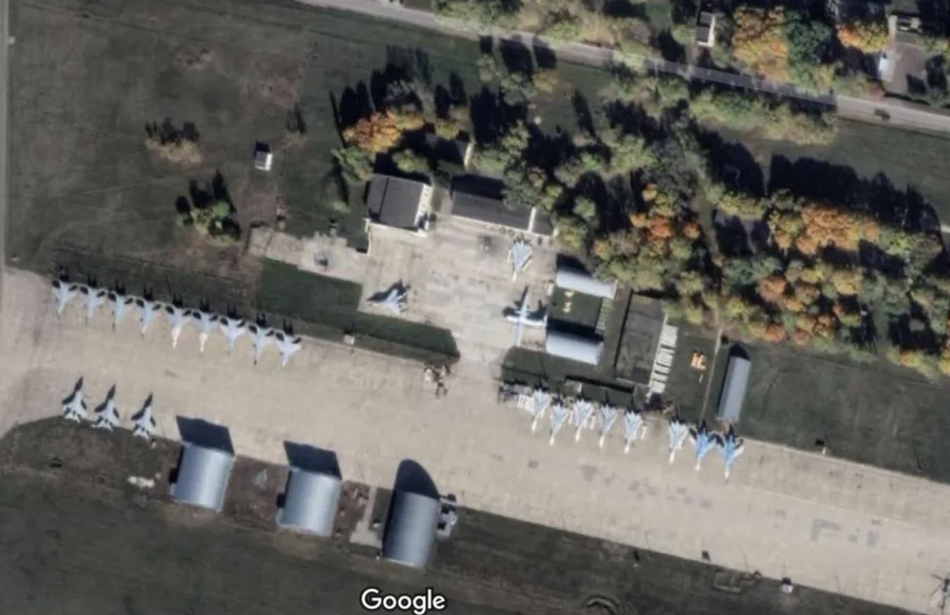
Google denied having changed the policy from Google Mapsso to eliminate censorship of some military installations of Russia The news had been making the rounds in recent hours after some Twitter users posted some satellite photos of various Russian airbases, suggesting the images were viewable by a specific choice of Google.
Google normally censors satellite images of almost every area of military importance. The affected area appears grainy and therefore not visible to users.
It was rumored on Twitter that Google had lifted this censorship, referring solely to Russian military structures, as a form of support for theUkraine The company denied making such a decision, on the contrary, arguing that all images circulating online were visible from before the outbreak of the conflict in Ukraine. In addition, some of the circulating images showed at least a Russian military base with an internal museum, so much so that in the photos, in addition to military fighters, a shuttle was also clearly distinguishable. Buran and a Su-47an experimental aircraft of which only one remains.
“Now all users can view a large number of Russian rocket launchers, ICBMs, command posts and air bases with a resolution of about 0.5 meters per pixel,” the account tweeted. @ArmedForcesUkr The tweet went viral, thanks to thousands of shares.
The images are real and it is actually possible to search and see the bases in question directly from Google Maps. However, the company explained that this is nothing new: “These are all images that have been on Google Maps for several months, long before the outbreak of the war in Ukraine,” a Google spokesperson told The Verge.
While Google tends to censor much of the relevant military facilities, the company doesn’t block all sites completely. And that also applies to western countries. The Verge cites a few examples: it is possible to consult satellite images of the US Air Force Base Nellis and even some parts of Area 51.
Source: Lega Nerd


