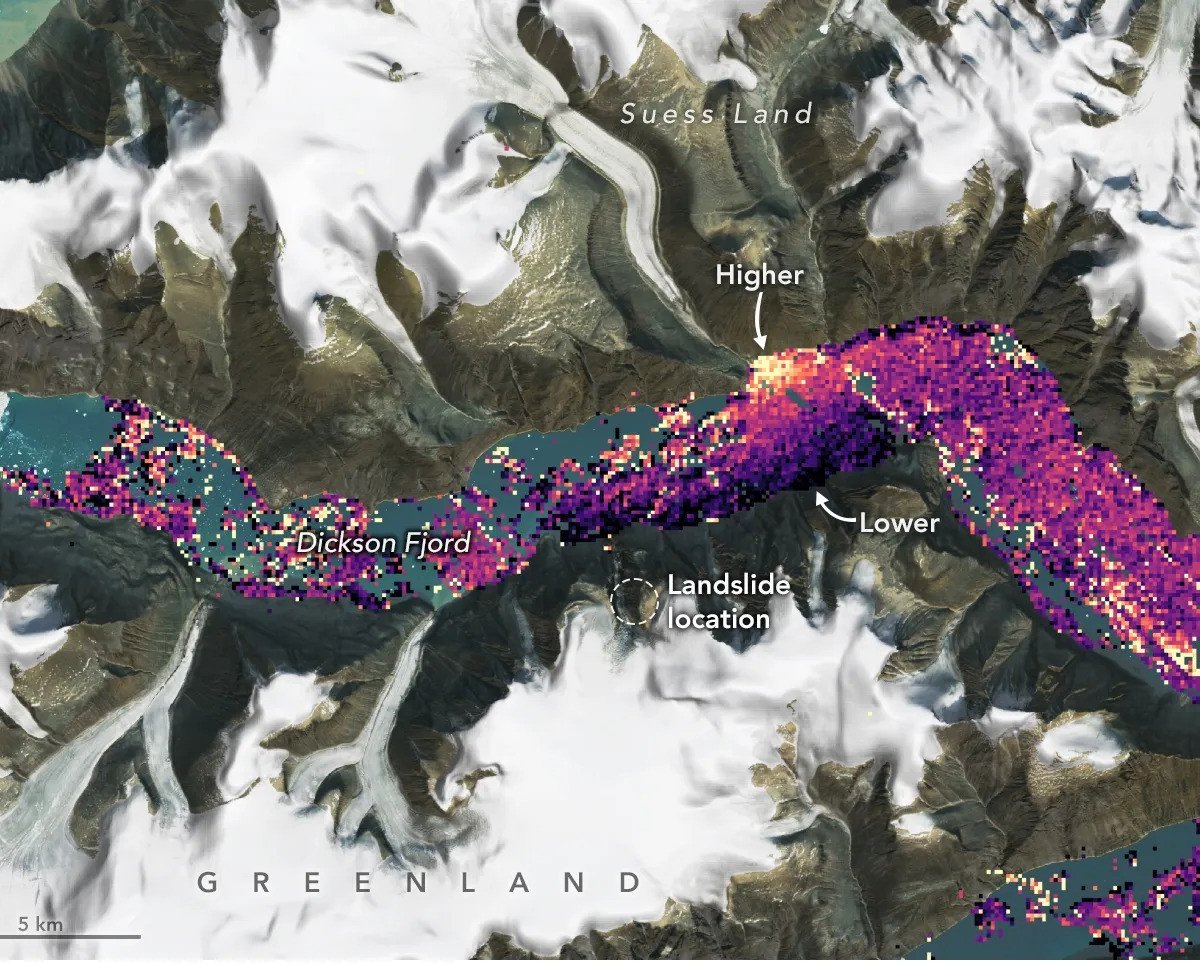
The mission team detected a large tsunami using data collected by the Surface Water and Ocean Topography (SWOT) satellite in partnership with the United States National Aeronautics and Space Administration (NASA) and France’s National Center for Space Research (CNES). Greenland in September 2023.
The information was detected only a day later the shifting of rocks and ice that causes the initial movement of the tsunami.
When comparing these measurements with other measurements taken under normal conditions, scientists noticed a significant increase in water levels in some places. The level in the north of Dickson Fjord was up to 1.2 meters higher than in the southern partl.
The researchers described this discovery in a study published in the scientific journal Science; they explain this The tsunami was caused by approximately 25 million cubic meters of rock and ice falling in the area.
Shortly after the event, seismic instruments recorded the displacement dissipating in a synchronized “back and forth” motion every 90 seconds; In total, this process took nine days.
“SWOT flew at a time when the water was rising towards the north wall of the fjord. Seeing the shape of the wave was something we could never do before SWOT,” said a offshore crew member and level surveyor. Josh Willis at NASA’s Jet Propulsion Laboratory in Southern California.
SWOT Satellite
The team explains that SWOT’s Ka-band Radar Interferometer (KaRIn) instrument measures the height of water in oceans, lakes, reservoirs, rivers, and nearly all water on the planet’s surface.
Additionally, this satellite capability demonstrates: Potential to be an excellent system for detecting natural disasters such as tsunamis and reducing risks to public safety.
Located approximately 900 kilometers from the Earth’s surface, SWOT was developed in partnership with NASA, CNES, the Canadian Space Agency (CSA) and the United Kingdom Space Agency. The satellite, launched in December 2022, is also used in other ongoing research.
“The resolution of the KaRIn radar was good enough to observe within the relatively narrow walls of the fjord. The footprint of conventional altimeters used to measure ocean height is too large to resolve such a small body of water,” said the KaRIn scientist. SWOT project Lee-Lueng Fu in an official NASA statement.
Stay up to date on the effects of climate change on planet Earth at TecMundo. If you wish, take the opportunity to understand how melting at the poles affects the Earth’s rotation and increases the length of days. Until next time!
Source: Tec Mundo
I’m Blaine Morgan, an experienced journalist and writer with over 8 years of experience in the tech industry. My expertise lies in writing about technology news and trends, covering everything from cutting-edge gadgets to emerging software developments. I’ve written for several leading publications including Gadget Onus where I am an author.


