


Many people do not believe that there is an earthquake in Brazil, but these natural phenomena can be felt in some parts of the country. For decades, scientists treated ‘Brazilian earthquakes’ as a different type of event, as they did not believe that major seismic events could occur in Brazil. However, in the last century, they realized that these geological events were actually earthquakes.
According to historical records, The first recorded earthquake in Brazil occurred in the city of Salvador in 1724.. In 1910, the American geologist Casper Branner published a work called “Earthquakes in Brazil”, stating that although earthquakes are rare, they also occur in the country.
“With natural population growth and increased communication opportunities, the frequency of earthquakes is likely to increase slightly in the future, but such an increase will be more visible than real,” Branner said. Said.
Currently, Brazil already has a network of seismographs that can provide detailed information about tremors, such as magnitude on the Richter scale (mR) and whether the event is low or high risk.
What are seismographs?
seismograph a A device that detects movements recorded on the ground and measures the magnitude and intensity of jolts. The main detection of seismographs is related to the duration and horizontal amplitude of seismic waves.
The seismographs are based on a system known as the Ritcher scale, created by scientists Charles Ritcher and Beno Gutenberg. The system is based on a continuous decimal scale from 2.0 to 10.0 – so far the planet has not recorded over 10.0 earthquakes.
For example, a magnitude 3.5 earthquake will only be recorded by seismographs, but a magnitude 5.4 earthquake will be felt by humans and may cause minor damage. Earthquakes above 8.0 can destroy buildings, create cracks in the ground and cause other major damage for hundreds of kilometers.
Seismographs also use the Magnitude of Moment (Mw) scale created by Thomas Hanks and Hiroo Kanamori as a way to measure the energy released from the magnitude of earthquakes.
How does the seismograph network work in Brazil?
Brazil has several seismographic stations in different regions controlled by the Brazilian Seismographic Network (RSBR). In total, the network consists of four institutes spread across the country, these are:
- South and Southeast Brazil Seismographic Network (RSIS);
- Northeast Brazil Seismographic Network (RSISNE);
- Brazilian Integrated Seismographic Network (BRASIS);
- Central and Northern Brazil Seismographic Network (RSCN).
The network receives an agreement from the Mineral Resources Research Corporation (CPRM) and the National Observatory to maintain the equipment and continue the project.

The RSBR consists of dozens of high-performance seismography stations operating continuously in different regions of Brazil, equipped with equipment capable of detecting high- and low-risk seismological patterns. The networks are coordinated by different universities and institutes across the country. In fact, it was built to better understand the structure of the Earth and the pattern of seismic activity in Brazilian soil.
The equipment measures terrestrial emissions and is based on different technologies; From these, scientists can determine ratios on the Richter scale and determine whether events are dangerous. Enthusiasts can even access the official RSBR website to access updated information with data from Brazilian seismography stations.
Are there earthquakes in Brazil?
Residents of the cities of São Paulo, Sorocaba, Peruíbe and other parts of the state, At 8:22 am on June 16, 2023, he reported a severe shaking. The tremor was 4.0 on the Richter scale and did not cause serious concern, according to information from the University of São Paulo Seismology Center (USP).

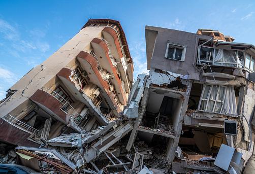
In 2022, a 6.5 magnitude earthquake with a depth of more than 600 kilometers was detected in a border region between Brazil and Peru. According to a warning from the United States Geological Survey (USGS), Less than an hour later, the earthquake produced a magnitude 4.8 aftershock. – Despite what is considered the largest earthquake ever recorded in Brazil, the tremor began in an area in Peru. Fortunately, the earthquake did not cause any damage like the 7.8 magnitude earthquake that occurred in Turkey a while ago.
Following the 4.6 magnitude earthquake that struck Bahia in September 2020, a team of RSISNE experts under the coordination of the Federal University of Rio Grande do Norte (UFRN) Seismology Laboratory installed nine seismological equipment in seven Bahia cities. In July of the same year, an earthquake measuring 3.5 on the Richter scale was recorded off the southern coast of Bahia.
In any case, it is important to emphasize that Brazil is in a region of the Earth that is considered stable, and each year the country records low-intensity tremors that are not always felt by the population. In many cases, the tremors are echoes of earthquakes in other parts of Latin America, such as Argentina and Peru.
Source: Tec Mundo
I’m Blaine Morgan, an experienced journalist and writer with over 8 years of experience in the tech industry. My expertise lies in writing about technology news and trends, covering everything from cutting-edge gadgets to emerging software developments. I’ve written for several leading publications including Gadget Onus where I am an author.


: Everything we know a week after its release")


