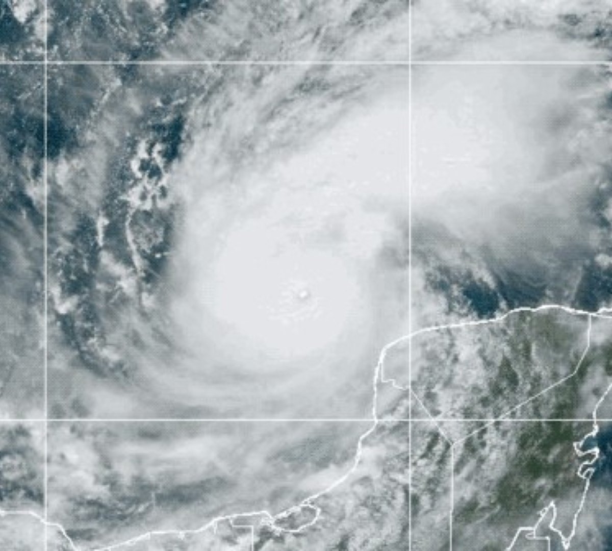
International Space Station (ISS) external cameras Impressive images were taken of Hurricane Milton, classified as Category 5 In the latest update (most extreme) from the US National Hurricane Center (NFC). Images show the atmospheric phenomenon passing through the Gulf of Mexico towards Tampa, Florida, where it is expected to arrive Wednesday night (9).
In the video, recorded at 8:37 a.m. (Brasília time) on Oct. 8, 233-kilometer-per-hour winds were strengthening in Milton and moving east-northeast toward the west coast of the so-called American Sunshine State.
What quickly caught the astronauts’ attention was the “pinhole eye” of the massive hurricane. This structure refers to an extremely small “eye”, usually less than ten nautical miles (about 18.5 km) in diameter. This is much smaller than typical hurricane eyes, which are usually between twenty and forty miles (32 and 64 km) in diameter.
Magnitude of Hurricane Milton
After Hurricane Milton went from a category 1 to a category 5 on the Saffir-Simpson scale (7) in a matter of hours, Fox 35 Orlando meteorologist Noah Bergren became emotional. He described in his X profile: “This hurricane is approaching the mathematical limit of what the Earth’s atmosphere over this ocean water can produce.”
Category 5 hurricanes pose an extreme threat to life and property wherever they pass.. This indicates sustained winds of at least 252 km/h; This could mean widespread risks such as complete collapse of wooden houses, major damage to concrete buildings, and falling roofs and walls.
Electricity and communication poles, as well as large-scale trees, may be cut down. The extreme risk of coastal flooding is causing residents in the most seriously threatened areas to flee their homes. The debris left behind by Hurricane Helene just two weeks ago may increase the vulnerability of affected communities.
Is Hurricane Milton the last hurricane to hit the United States this year?
After two hurricanes passed through in less than 30 days, many people may think this is an abnormal event. But Matthew Rosencrans, hurricane season forecaster for the NOAA Climate Prediction Center, says that’s not the case.
He said in an interview with Business Insider: Although hurricanes arrived earlier this year, storms in the Gulf are typical of OctoberThe formation of these tropical storms normally occurs in the second half of October and ends only by the end of November.
According to experts, it is very likely that Milton will not be the last storm we see this season. He advised everyone, even those living in areas not currently affected but at risk of hurricanes, to check their supplies and remain vigilant.
I always follow the latest news from the world of science at TecMundo. If you wish, take the opportunity to understand how hurricane names are chosen.
Source: Tec Mundo
I’m Blaine Morgan, an experienced journalist and writer with over 8 years of experience in the tech industry. My expertise lies in writing about technology news and trends, covering everything from cutting-edge gadgets to emerging software developments. I’ve written for several leading publications including Gadget Onus where I am an author.


